Superior National Forest Scenic Byway

View from an overlook along the Superior National Forest Scenic Byway

Typical view along the route
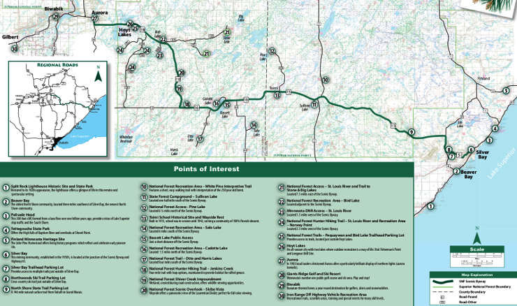
Superior National Forest Scenic Byway is an 85-mile route connecting Silver Bay on Lake Superior with communities in the historic Iron Range of northern Minnesota. The route follows Highways 5 & 15 in Lake County, Highways 16 & 110 in St. Louis County. A good portion of the route traverses a wild section of Superior National Forest: fishing, camping, hiking, snowmobiling galore! with no towns over a 54-mile stretch. History at sites like the 1913 Toimi School, the White Pine Interpretive Trail, the Cadotte Lake and Bird Lake Recreation Areas and the Timber Arch Bridge.
There are several pulloffs, vista points and interpretive signs along the route. This is in a part of Minnesota that attracts fall color tourists in droves.
Click or tap on the image for a larger version
Upper left photo courtesy of Superior Byways
Upper photo courtesy of Explore Minnesota
Map courtesy of the US Forest Service