South Fork Owyhee River Wild and Scenic River
South Fork of the Owyhee River
The South Fork of the Owyhee River flows in southwestern Idaho. The 31.4 miles of stream between the Idaho-Nevada border and the stream's confluence with the Owhyee River cover the designated Wild & Scenic River stretch. The whole river is designated scenic while 30.2 miles are designated Wild and the remaining 1.2 miles designated Recreational (as that 1.2 miles crosses private land).
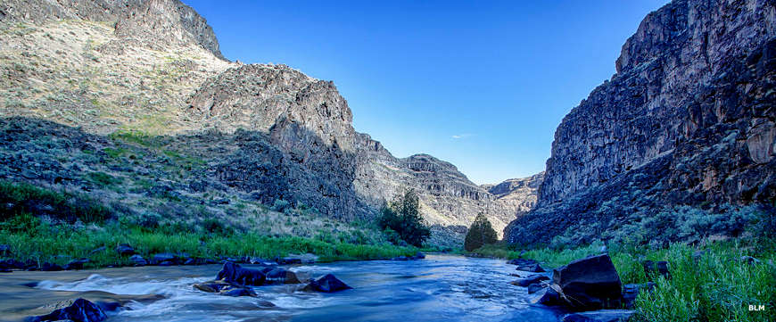
The South Fork of the Owyhee River canyon is dominated by a mixture of high, vertical lines and forms of eroded coarse brown, red, or blackish cliffs, often glazed with light green to yellow micro-flora. Talus slopes offer displays of yellow to green sagebrush-bunchgrass and/or dark green juniper, as well as reddish rhyolite or coarse-textured, blackish basalt rubble fields.
Spring waterflows bring brownish high water and rich riparian vegetation. Summertime low flows are usually tinted light green and brown channel colors and expose the whitish stream-bottom gravel and boulders.
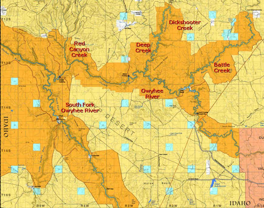
Created by extensive volcanic activity during the Miocene Epoch (24 to 5 million years ago), the region is part of the largest concentration of sheer basalt/rhyolite canyons in the western United States. Other rivers in the Owyhee Uplands drainage area also designated Wild and Scenic include Battle Creek, the mainstem of the Owhyhee River, Dickshooter Creek, Deep Creek, Duncan Creek and Red Canyon Creek.
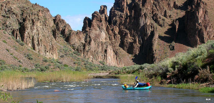
Kayaking the South Fork of the Owyhee River
Photos courtesy of the Bureau of Land Management
Related Pages
Map courtesy of the Bureau of Land Management