Lake Manatee State Park

Lake Manatee State Park

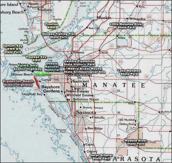
The 556-acre Lake Manatee State Park is located on the southern side of Lake Manatee, 15 miles east of Bradenton in Manatee County. Lake Manatee itself is a 2,400-acre reservoir that feeds drinking water to Bradenton and Sarasota. The name doesn't mean anything: you won't see manatees in this lake because they can't get upstream past the Manatee Dam.
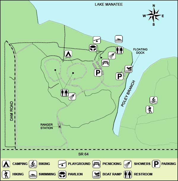
Lake Manatee State Park offers canoeing, kayaking, boating, fishing, swimming, picnicking and camping. There are also a boat ramp, dock and picnic area in addition to the 60-site full hook-up campground. Boat motors are limited to 20 horsepower or less. Swimming is allowed only in the designated swim area and there are rinse showers nearby. Fishermen seem to have good luck going for bluegill, crappie, catfish, and largemouth and sunshine bass. There are also several hiking, biking and horseback riding trails on the property.
The landscape is typical central Florida with sand pine scrub, pine flatwoods, hardwood hammocks and freshwater marshes. Among the wildlife at the state park you'll find a lot of green turtles, a few osprey and a few alligators. You might also find herons, egrets and limpkins feeding around the lake shore.
To get there: Lake Manatee State Park is located on State Road 64, about 9 miles east of Interstate 75, about 15 miles east of Bradenton. The park is open for day use from 8 am to sunset, every day of the year.

Near the beach at Lake Manatee State Park
Upper photo courtesy of Larry Arrington, Florida State Parks
Other photos and map courtesy of Florida State Parks
Other photos and map courtesy of Florida State Parks
Related Pages
Area map courtesy of National Geographic Topo!