Gulf Islands National Seashore
Horn Island, Gulf Islands National Seashore
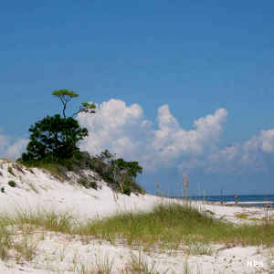
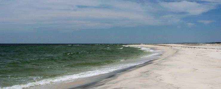
Gulf Islands National Seashore is spread across the barrier islands along the coast of Florida and Mississippi. Featured here are multiple offshore islands with white sandy beaches, nature trails, warm waters of the Gulf of Mexico and even some historic fortifications. All of the Florida sections of the seashore are accessible via automobile. Only the Davis Bayou area is car accessible in the Mississippi section. Horn, Petit Bois, East and West Ship, and Cat Islands are accessible only by boat. Sections of Horn and Petit Bois Islands are contained within the 4,080-acre Gulf Islands Wilderness (so it is possible to enjoy a wilderness adventure along the Gulf Coast of Mississippi).
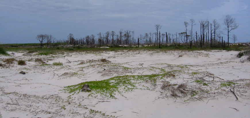
The 2004 and 2005 hurricane seasons delivered significant structural damage to the property, and most of that damage hasn't been repaired. In the aftermath of those hurricanes, a lot of things aren't back to normal, including the hours that certain places are open, if they are open. But most places that have any kind of closure times are open from 8 am to sunset. The Naval Live Oaks Visitor Center is open daily from 8:30 am to 4:30 pm.
These beaches and islands also took a hard hit from the wondrous BP oil spill disaster in the Gulf of Mexico in 2010.
Petit Bois Island, Gulf Islands National Seashore
Upper photo courtesy of Wikipedia userid Zach123abc, CCA-by-SA 3.0 License
Upper left photo courtesy of the National Park Service
Lower photo courtesy of Wikipedia userid B-Rich, CCA-by-SA 3.0 License
Upper left photo courtesy of the National Park Service
Lower photo courtesy of Wikipedia userid B-Rich, CCA-by-SA 3.0 License
Related Pages
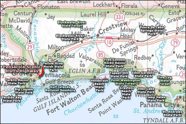
Area map courtesy of National Geographic Topo!