Zapata Falls Recreation Area

Zapata Creek emerging from a cleft in the glacial moraine

Two million years ago, the Sangre de Cristo Mountains were covered with glaciers that were busy carving some spectacular gorges in that upthrust fault block of Pennsylvanian/Permian rock about 250 million years old. Zapata Falls is on the western side of the Blanca Massif, a spur of the Sangre de Cristos that is an area of pushed up granite formed about 1.8 billion years ago (meaning the Blanca Massif is considerably older than the main Sangre de Cristo Range). The glaciers in this area reached down into the foothills but never out onto the floor of the San Luis Valley. As the climate warmed in those days and the glaciers retreated, a low dike of hard-pressed rock was left behind. The glacial meltwaters were held back by that dike until they found a soft spot and poured through the rock barrier, emptying onto the San Luis Valley floor and then sinking into that glorified gravel pit (there is a rise in the valley floor just to the south and west that prevented most of that water from reaching the Rio Grande and flowing south).
Over the years, continued water flow through that crack has eroded a very narrow gorge (essentially a slot) in the hardened rock until today, we have Zapata Falls. I have visited Zapata Falls several times over the years but only got into the cleft in the rock once. That was an early spring day when snowmelt season had hardly begun. Every other time I was in the area, the water flow was too high and climbing into the gorge too dangerous. Most years, the waterfall never fully thaws. To get to the falls, you need to go wading in the creek, climb a short ladder and make your way through and over a series of slick boulders and rocks deep into the gorge. Once there, you'll see the water actually drops about 30 feet through a small opening in the roof of the gorge. You'll also experience the nearly 30°F drop in temperature brought about by being inside that insulating rock.
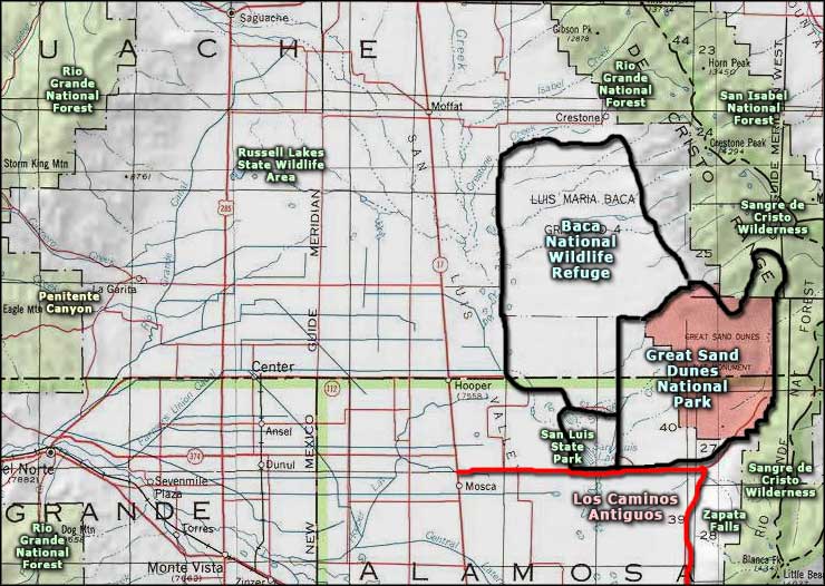
The waterfall itself is about a half-mile walk up the hill from the parking area. The parking area is about 4 miles up the hill from Colorado Highway 150. Colorado Highway 150 runs from US Highway 50 to the south and ends to the north at the entrance to Great Sand Dunes National Park. The turnoff to Zapata Falls is well signed on the east side of the road. A little further north is Zapata-Medano Ranch, a property owned and managed by The Nature Conservancy.
The parking area also serves as a trailhead for hiking trails that wind up into the western slopes of the Blanca Massif: California Peak, Twin Peaks, the Zapata Lakes, etc.
South Zapata Creek never makes its way to the floor of San Luis Valley any more. As part of the Rio Grande Compact (which caused the water diversion program known as the "Closed Basin Project"), the stream's water is collected into a high-suction pipeline just below Lake of the Falls and is sent underground to empty in the Rio Grande. It's that high-suction pipeline that makes swimming in Lake of the Falls so dangerous (never mind the frigid temperature of that water).

Zapata Creek out in the open

Twin Peaks to the south

The view west across the San Luis Valley

The view north to the Great Sand Dunes

In the parking area
Related Pages
Map courtesy of National Geographic Topo!