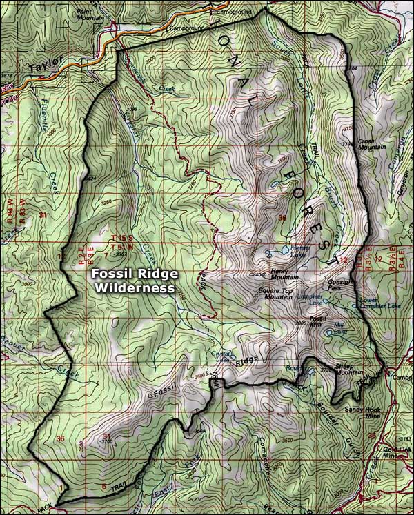
Fossil Ridge Wilderness
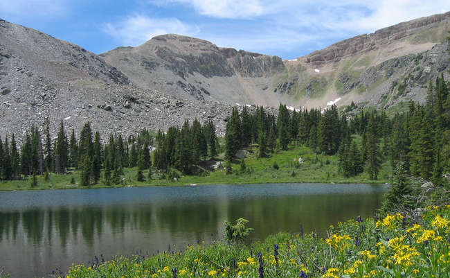
Square Top Mountain in Fossil Ridge Wilderness
Fossil Ridge Wilderness is a small wilderness of about 31,534 acres located about 16 miles northeast of Gunnison on Gunnison National Forest. Fossil Ridge Wilderness is a beautiful, glacier-carved mountain hideaway, complete with raw granite towering above deep, long, forested valleys. The namesake limestone ridge rises well above 13,000' and yes, it contains many fossilized remains of Cretaceous and Jurassic sea creatures. The area contains several high mountain lakes. You'll find scars left on the land by gold prospectors in some areas, too. There are 26 miles of trail within the wilderness open to foot and horse travel. One of these trails runs from Lamphier Lake to the summit of Square Top Mountain (12,985') where you'll get a view of maybe half the 14er's in Colorado.
For wildlife there's elk, mule deer, mountain lion, bobcats, fox, Bighorn sheep, black bear and mountain goat. The lakes support a good population of introduced trout while the Taylor River along the northern boundary of the property is famed for its cold water trout fishery.
The Fossil Ridge Wilderness is surrounded by the BLM Fossil Ridge Recreation Management Area which is about 44,000 acres in size. Roads and trails within the Recreation Management Area are open to mechanized and motorized uses. The Fossil Ridge Trail is a very popular motorcycle trail within the RMA.
Fast Facts about Fossil Ridge Wilderness
- Size: 31,534 acres
- Designated: 1993
- Elevations: 9,000' to 13,254'
- Miles of Trails: 26
- Game Management Unit: 55
- Latitude: 38.683333°N Longitude: 106.633333°W
Related Pages
Map courtesy of National Geographic Topo!