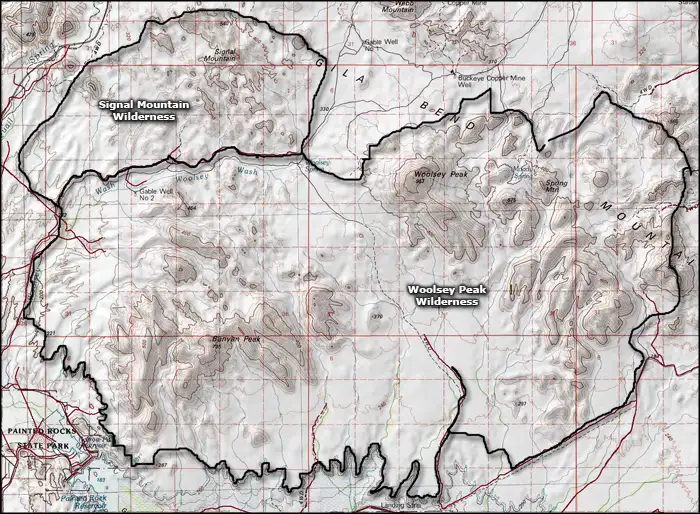
Woolsey Peak Wilderness
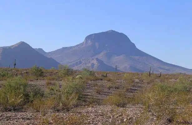
Woolsey Peak, namesake of Woolsey Peak Wilderness
Woolsey Peak Wilderness is a 64,000-acre property in southwestern Arizona. This is an ancient ocean bottom landscape where the mountains get their size only in relation to how low and flat the surrounding bajadas and desert floor are. Woolsey Peak itself stands 3,270 feet above sea level, about 2,500 feet higher than the Gila River that flows by only a few miles to the south.
This is prime Sonoran Desert: basalt mesas, broken ridges and ragged peaks above sloping lava flows and gravel bajadas, all speckled with paloverde, cholla, bursage, creosote bush, ironwood and giant saguaro. There aren't a lot of them but you just might come across mule deer, mountain lion, bobcat, desert bighorn sheep, owls, hawks and the usual assortment of reptiles, amphibians and desert songbirds.
Woolsey Peak Wilderness is separated from Signal Mountain Wilderness by a jeep trail.
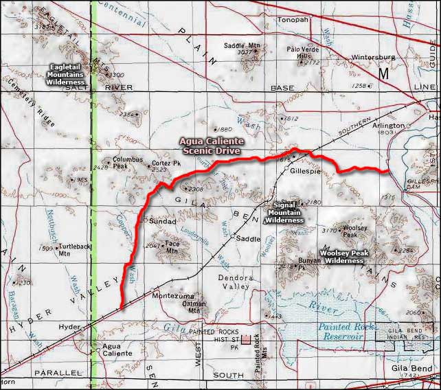
To get there: from the north there are several jeep trails extending south from Agua Caliente Road; from the south you can take the Painted Rocks Dam Road north from Interstate 8 and look for jeep trails heading north and east. To get anywhere near the wilderness boundary, you will need high-clearance on a 4WD vehicle.
7.5-minute Topo Maps: Citrus Valley West, Citrus Valley East, Quail Springs Wash, Woolsey Peak, Spring Mountain and Dendora Valley
Related Pages
Map courtesy of National Geographic Topo!