Salome Wilderness

Hell's Hole

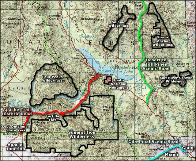
Salome Wilderness contains about 18,530 acres in the Sierra Ancha Mountains northeast of Roosevelt Lake. The majority of the wilderness is the canyon containing Salome and Workman Creeks, the upper boundary of the wilderness being defined mostly by the rim of the canyon. Owing to the steepness of the canyon walls and the "slot" nature of the stream beds (vertically eroded into pink granite), cross-country travel is exceedingly difficult. Elevations range from a low of 2,600 feet where Salome Creek emerges from the wilderness above Roosevelt Lake to a high of about 6,500 feet on Hopkins Mountain. As you can see from the photos on this page, making your way through the bottom of the canyon might be very hazardous to your health in spots.
Of the defined trails that do exist, one leaves from the trail head at Reynolds Campground (along the From the Desert to Tall Pines Scenic Road) and works its way down the side of the canyon below Workman's Creek to the bottom of Hell's Hole. Another branches south from that and follows an old jeep trail to the west of Hopkins Mountain, eventually ending on Boyer Ridge to the west of Thompson Mesa. The only other trail that accesses the wilderness leaves from a trail head along the road that skirts the edge of Roosevelt Lake and essentially travels along the southern edge of the wilderness area until it dead-ends at Salome Creek. I have come across reports from some hardy (some might say "foolhardy") souls who traveled down the stream beds to the bottom of the wilderness. Personally, that's an adventure that is physically beyond my means at my age... but this is Mogollon Rim country at its finest. And the map below says the lower reaches of Salome Creek shouldn't be too bad (as long as it isn't raining anywhere up the hill) until you get into that upper area below Hell's Hole. But there are no marked or maintained trails in the bottom of the canyon, probably because of intermittent flash flooding. If you're in the bottom of the canyon when a good rainstorm hits, there isn't much in the way of feasible escape route... This area freezes in the winter and temps pass 100°F regularly in the summer.

Map courtesy of National Geographic Topo!
Related Pages
Map courtesy of National Geographic Topo!