Mount Baldy Wilderness

Hiking the East Fork Trail at Mount Baldy Wilderness

Mount Baldy Wilderness is a 7,079-acre property on the eastern boundary of the White Mountain Apache Indian Reservation in eastern Arizona. Mount Baldy itself is an extinct volcano and the summit of the mountain (11,403') is just inside the reservation boundary (making it off-limits to anyone who does not have a permit from the tribe).
In the 1870s Captain George Wheeler and his crews surveyed much of the southwestern states. Wheeler climbed Mount Baldy, enjoyed the view and said he found it "the most magnificent and effective of any among the large number that have come under my observation." Mount Baldy is still one of the most popular hiking spots in Arizona.
The forest covering Mount Baldy is a mix of Ponderosa pine, Douglas fir, spruce and aspen. The forest is broken up in places with large grassy, wildflower-filled meadows. Among the wildlife in Mount Baldy Wilderness you might find elk, mule deer, black bear, mountain lion, bobcat, bald eagle, peregrine falcon, red-tailed hawk and many varieties of smaller birds and mammals.
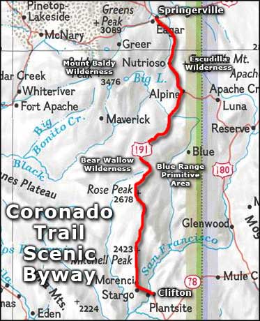
USGS Maps: 279 NE Mt. Ord, 280 NW Big Lake

Rock outcroppings on Mount Baldy

Mount Baldy Wilderness
Upper photo is courtesy of Arizona Hiking
Lower photo courtesy of Al_HikesAZ, CCA-NC 2.0 License
Other photo courtesy of the US Forest Service
Map courtesy of National Geographic Topo!
Lower photo courtesy of Al_HikesAZ, CCA-NC 2.0 License
Other photo courtesy of the US Forest Service
Map courtesy of National Geographic Topo!
East Baldy Trail
This 14-mile (round trip) trail is rated as moderate but it does have some strenuous sections. Usage is moderate most of the year but that section of time between Memorial Day and Labor Day can see heavy traffic. Snowdrifts can block upper portions of the trail as late as June.
This trail is foot or horseback only as it enters and travels in the Mt. Baldy Wilderness. The trail parallels the East Fork of the Little Colorado River through a long meadow for about 1.5 miles, then it reaches the timber and heads uphill. In this first half mile up you'll gain about 800 feet in elevation, then the uphill grade eases off a bit. Lots of sandstone boulders interspersed among the stands of mixed conifers. And the views are something else: Big Lake, Crescent Lake, White Mountain Apache Reservation, Black River Valley, Escudilla Mountain, the Blue Range and into the Gila National Forest in New Mexico.
This trail merges with the trail from Sheeps Crossing (West Baldy Trail) in a saddle below Mt. Thomas, about 7 miles from the trailhead where you probably left your car. This is almost to the top of Mt. Baldy but unless you are a tribal member of the White Mountain Apaches, the summit is off-limits. You can either head back the way you came or go 7 miles across the hill to Sheep's Crossing and find your way back to the car from there.
As this is wilderness area, sign in at the trail head register and leave your mountain bikes, motorized vehicles and power tools behind (cameras seem to be okay, though). Groups are limited to 12 hikers or riders, 6 for camping.
Elevation: 9,300' to 11,200'
Access: There is one trailhead on the north side of the East Fork of the Little Colorado, off of AZ 273. There is a second one at Gabaldon Campground. The two trails merge within 1/4 mile of their starting points.
West Baldy Trail
This trail is rated as moderate and is 14 miles, round trip from the parking lot at Sheeps Crossing. The trail usually sees moderate use but traffic can be heavy from Memorial Day to Labor Day. Sometimes snow drifts can block parts of the trail into June.
At the edge of the parking area is the visitor register. From there, the West Baldy Trail heads for the West Fork of the Little Colorado and follows that steadily up for about 2 miles. This part of the trail sees the most people but the crowd thins out as soon as the going gets tough. The trail crosses the West Fork on an old bridge and continues a steady but not hard uphill grade. At a certain point you will leave the stream behind and traverse a series of switchbacks as you head up to the saddle just below Mt. Thomas where this trail meets the East Baldy Trail. The summit of Mt. Baldy is on the Reservation and if you aren't a tribal member, it's off limits. From here you can choose to go back the way you came or go down on the East Baldy Trail. Either way, it's 7 miles down.
This is in the Mt. Baldy Wilderness so no mountain bikes, motorized vehicles or power equipment. Groups are limited to 12 hikers or horseback riders, 6 for camping.
Elevation: 9,000' to 11,200'
Access: The trail head is off of State Road 273 at Sheeps Crossing.
Related Pages
Map courtesy of National Geographic Topo!