Taylor Highway
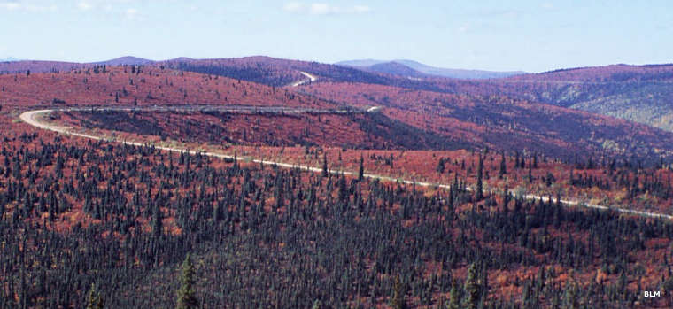
A Taylor Highway view in the fall
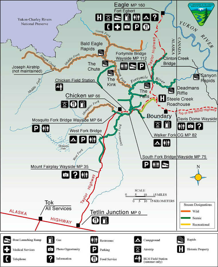
Taylor Highway is a 160-mile route connecting Tetlin Junction (about 11 miles south of Tok on the Alaska Highway) with the historic town of Eagle. The first 60 miles of the road is paved, the rest a mix of gravel and dirt. At the south end is the Tanana River, at the north end the Yukon River.
Services along Taylor Highway are limited essentially to Tok, Chicken and Eagle. The road shoulders tend to be soft and the route itself has many blind curves as it follows ridgetops and parallels the Fortymile River. There are a few pullouts along the way and at least four good boat access points to the Fortymile Wild & Scenic River. The BLM maintains three campgrounds in the area: West Fork, Walker Fork and in Eagle. Overnight camping is not allowed in any of the BLM waysides along the road.
The Taylor Highway was built in 1953 to connect Eagle and Chicken with the Alaska Highway. It connects with Top of the World Highway at Jack Wade Junction, about 96 miles north of the Alaska Highway. Top of the World Highway runs east from there to Dawson City in Canada's Yukon Territory.
From October through April the road is closed to vehicles by snow. Those months see all traffic happening via snowmobile. In addition to the bears, moose, wolves, lynx and other wildlife around, the Fortymile caribou herd roams the area, too.
Photos and map courtesy of the Bureau of Land Management