Gates of the Arctic National Park & Preserve
Gates of the Arctic National Park
At 8,472,506 acres, Gates of the Arctic National Park is the second largest national park in the United States. The entire park is north of the Arctic Circle. President Jimmy Carter signed the paperwork on December 1, 1978 that designated this area as a National Monument. National Park status was automatic as soon as the 1980 Alaska National Interest Lands Conservation Act was signed. A large part of the property is preserved as Gates of the Arctic Wilderness. The area supposedly got its name during an expedition with wilderness activist Bob Marshall. He was exploring the upper reaches of the North Fork of the Kobukuk River when he came to Frigid Crags and Boreal Mountain. The two mountains stand silent sentry on both sides of the river, so he gave this the name "Gates of the Arctic" and the moniker has stuck.
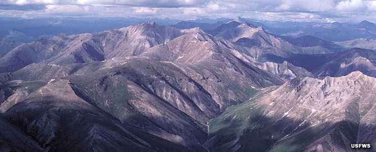
The park mostly contains landscape of the Brooks Range: high, sharp, glaciated peaks that drop to glacier-carved valleys. The snowmelt feeds into the tributaries of several rivers, six of which (John River, Alatna River, Koyukuk River, Kobuk River, Tinayguk River and the Noatak River) are designated National Wild & Scenic Rivers.
Geologically speaking, much of the landscape rises above a crystalline basement into a band of partially metamorphized PreCambrian and Paleozoic sedimentary layers. Above that is a band of middle Cambrian sediments, then the Kanayuk Conglomerate: a river delta deposit up to 30 miles wide, 500 miles long and 8,000 feet deep. The Kanayuk Conglomerate was deposited during the Devonian era and continued into the early Carboniferous era. The landscape we see today has been heavily carved by glaciers since before the last Ice Ages.
The upland regions of Gates of the Arctic are primarily tundra and exposed rock. Conifers and shrubs begin to appear down in the valleys but once the valleys exit the mountains tundra takes over again. In this countryside you might come across caribou, moose, barren-ground grizzly bear, black bear, Dall sheep, arctic and gray wolf, red fox, wolverine, beaver, river otter, muskrat, marmot, pine marten and mink.
There are no roads that access the park. No trails, no campgrounds, no visitor facilities of any sort. There are 10 small villages, about 1,500 people in all, who live inside the boundaries of the park, in a special "resident subsidence zone." The Dalton Highway passes by about 5 miles east of the eastern boundary and the National Park Service participates in an interagency visitor center at Coldfoot on the Dalton.
Gates of the Arctic National Park is about four times the size of Yellowstone National Park and sees significantly fewer visitors...
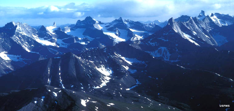
The Arrigetch Peaks in Gates of the Arctic National Park & Preserve
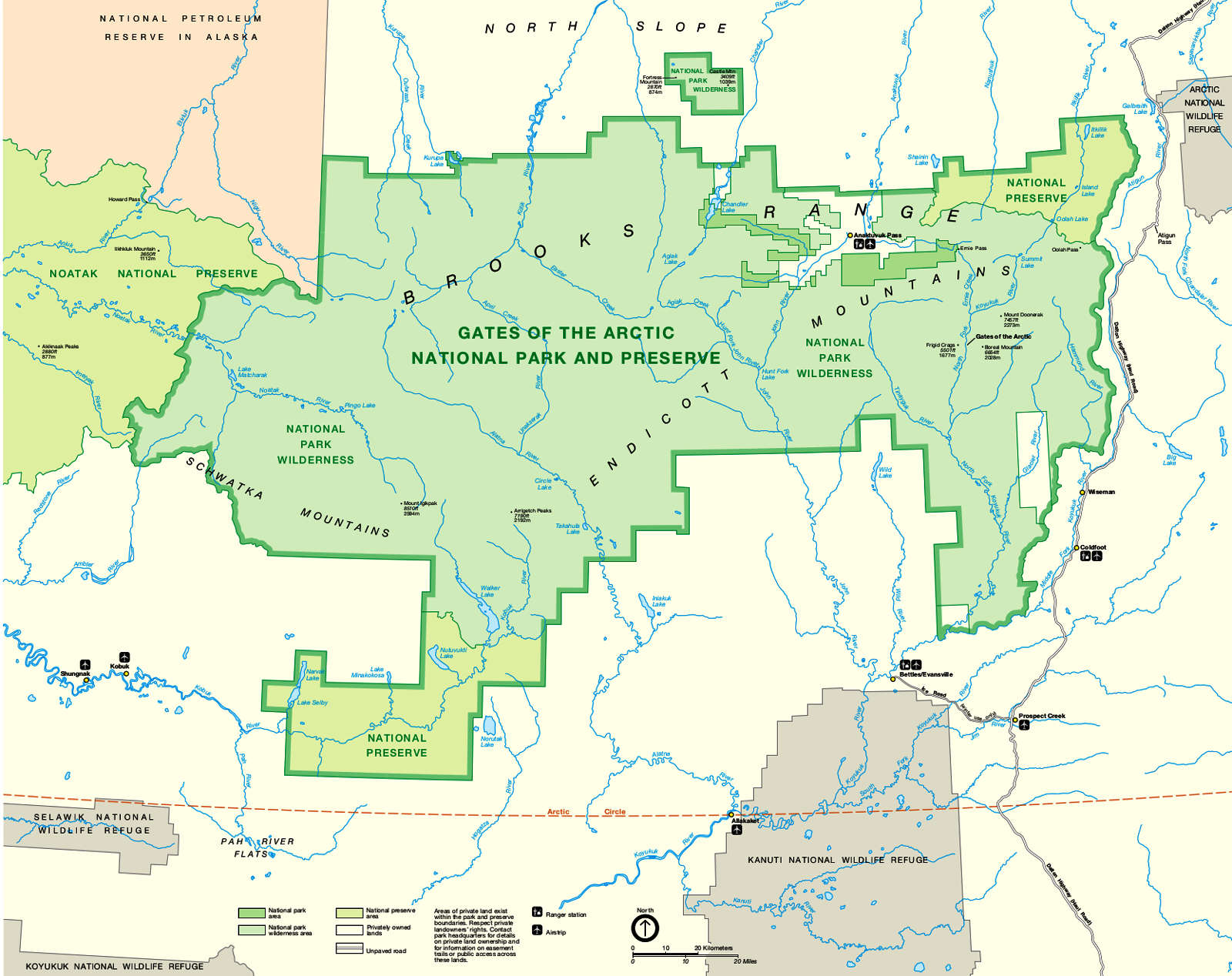
Click or tap on the map to see a larger version
Photos courtesy of the US Fish & Wildlife Service
Maps courtesy of the National Park Service